

UtiliView™
Real-Time Mapping.
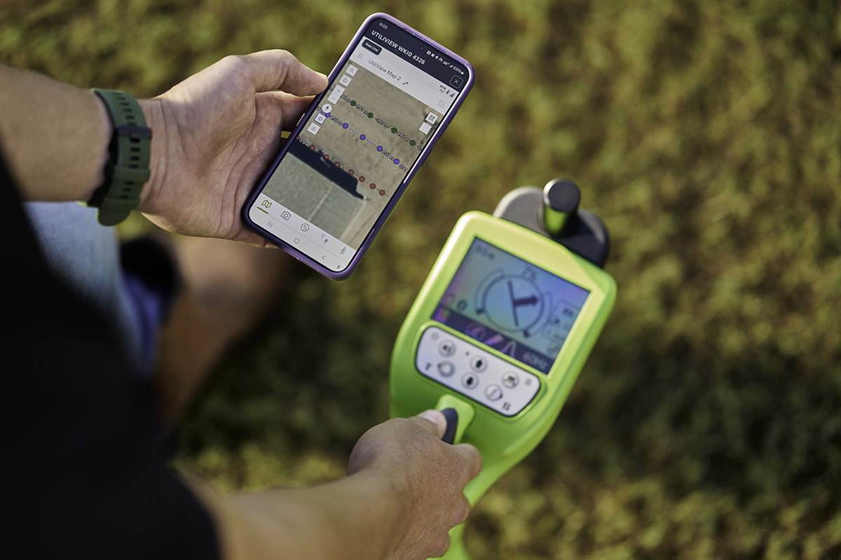
UtiliView is the ultimate solution for Subsite® utility locators, seamlessly integrating UtiliGuard® 2 RTK and Esri mapping service to streamline your workflow.
By eliminating transcription errors and offering instant Bluetooth connection to log critical data, UtiliView ensures accuracy, efficiency, and security every time. Accessible on both Apple® and Android™ devices, UtiliView keeps your team updated in real-time, helping you get the job done faster and smarter without the hassle.
Download the app.
Key Features.
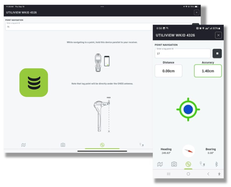
- Esri™ Cloud Services – Access and integrate your data from anywhere while keeping everything securely stored in a private environment.
- Correction Services – With the UtiliGuard 2 RTK, you can achieve centimeter-grade accuracy, ensuring pinpoint precision with every locate.
- Log Point Photos – Easily add photos to your log points, providing visual documentation for clearer, more complete records.
- Instant Distance Measurements – Save time and increase record accuracy by getting instant distance measurements on located lines when logging multiple points.